

In this series of articles, Utah artist J. Brad Holt talks about what artists are seeing as they look at the landscape. Holt studied geology in college and is attentive to what the rocks suggest in the scenes he paints.
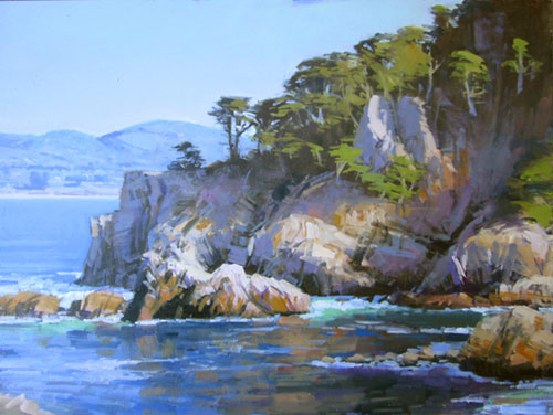
Lead Image: “Fisherman’s Wharf, Monterey,” by J. Brad Holt, 2015, oil, 12 x 12 in.
Three-quarters of the earth is covered by water. We all ultimately owe our existence to the ocean, the cradle of life on earth. Although mankind has lived and worked alongside the sea throughout our tenure on this planet, deriving our sustenance from the rich abundance of life found there, it is only recently in our history that we have begun to understand the topography and geology that lies beneath the waves.
The first comprehensive study of the ocean basins was conducted in the 1870s by scientists aboard a British Navy ship, the HMS Challenger. Numerous depth measurements were conducted using weighted lines, in every ocean save the Arctic. This gave us a rough idea of ocean depth, but did little to fill in the maps. It was not until the development of Sound Navigation and Ranging, or sonar, during the mid-20th century that a picture of the topography of the ocean floor began to emerge.
Sonar transmits a “ping” of sound energy that reflects back from the ocean floor. Because we know the precise speed at which sound travels through water, the delay in the echo can be used to obtain an exact depth. In graphic form this data can provide a detailed map of the ocean floor. Sonar can map only narrow slices, and ships with towed arrays move slowly. Only about 5 percent of the seas have been mapped in detail. In more recent years, satellites have used radar altimeters to bounce microwaves off the ocean surfaces. When compensations have been calculated for waves, currents, and weather, a surprisingly accurate picture of the ocean floor can be created based on slight changes in the surface level of the water.
There are three main geologic provinces under the waves. These are continental margins, deep ocean basins, and mid-ocean ridges. Continental margins are divided into passive and active margins. Passive margins have no active plate boundary; most of the coasts around the Atlantic and Indian oceans are of this type. These margins consist of a continental shelf, averaging about 50 miles wide and around 400 feet deep. Beyond this is a relatively steep continental slope, and a broad, slight incline called a continental rise, which may extend for many miles from the deep ocean basin. Many passive continental margins may be accumulating vast volumes of sediment washing off the continent. The continental shelf may begin to sink under the weight of sediment, forming a geosyncline. Eventually isostatic rebound will uplift these sediments, which will have become rock.
Active continental margins occur where oceanic lithosphere is being subducted beneath continental crust. Much of the coastline around both sides of the Pacific Ocean is of this type. Continental shelves are usually very narrow or non-existent, as the subduction zone and trench may be within 30 miles of the shore. The angle at which oceanic crust subducts varies. Ocean crust becomes denser with age — in fact, it is this tendency that causes it to subduct. As it becomes older, cooler, and denser, it becomes more dense than the rock in the mantle.
It is theorized that this is really the engine that drives plate tectonics. The oldest ocean crust is in the western and northern areas of the Pacific. It is thought that in these areas the ocean crust is subducting at almost a 90-degree angle. Active margins are associated with active volcanoes. Those subduction trenches not along continental margins will generally develop a volcanic island arc behind the trench.
The mid-ocean ridges mark the location of divergent plate boundaries. Although we term them ridges, they are usually 1,000 miles wide, and rise to about a mile above the abyssal plain. There is usually a rift valley running down the center of the rise. Sections of the ridges are often offset laterally, with the offset sections connected by transform faults running at 90-degree angles to the linear direction of the ridge.
Basaltic eruptions are constantly generating new ocean crust that is slowly rifted away on either side of the ridge. Erupting basalt is extruded, cooling almost instantly upon contact with seawater. The resulting blobs of basalt have a pillow-shaped form, and are called pillow basalts. As hot semi-solid mantle rock rises in the center of the ridge, the decrease in confining pressure results in decompression melting, causing a continuous low-grade eruption all along the axis of the ridge.
Magma is also injected into vertical cracks in the ridge, creating a complex of sheeted dikes intruding into the gabbro that forms the subsurface body of the ridge system. Gabbro is the intrusive equivalent of basalt. As new ocean crust moves away from the rise, it cools and sinks, having a fairly uniform depth of about seven kilometers. The pillow basalts, sheeted dikes, and gabbro that comprise the oceanic crust are together termed an ophiolite complex. As seawater circulates through subsurface cracks in the ridges, it is heated, and becomes rich in dissolved minerals.

Hydrothermal venting allows some of these minerals to precipitate out, resulting in rich deposits of economically valuable minerals. The vents are sometimes termed black smokers because they resemble smoking chimneys. Strange, isolated communities of living organisms often locate near these hydrothermal vents. These ecosystems use hydrogen sulfide-eating bacteria as a base for the community — rather than photosynthesis, which would be impossible in these dark depths.
Other topographic features of the sea floor include abyssal plains, seamounts, guyots, and oceanic plateaus. Abyssal plains appear perfectly flat and featureless because the rugged basalts of the seafloor are covered with a smooth veneer of sediment. Seamounts are formed by hotspot volcanism. Those islands that are eroded to a flat surface eventually sink beneath the waves as plate movement carries them away toward the deeper oceans around the trenches. The flat-topped seamounts are called guyots. Oceanic plateaus may be formed by more widespread, flood basalt volcanism, although the Rockall Plateau in the North Atlantic seems to be made of continental crust that has torn away from Europe and sunk beneath the waves, with the exception of one tiny point, known as Rockall Islet. No, this is not Atlantis — not unless Homer knew what was going on many millions of years ago.


